PDF
Master file
unita.pdf

Area dell'identificazione
Segnatura/e o codice/i identificativo/i
IT ANPI-PU ANPI-PU-01-7-69-b.134-fasc.69-69-b.134-fasc.69-6-Cartella 4
Titolo
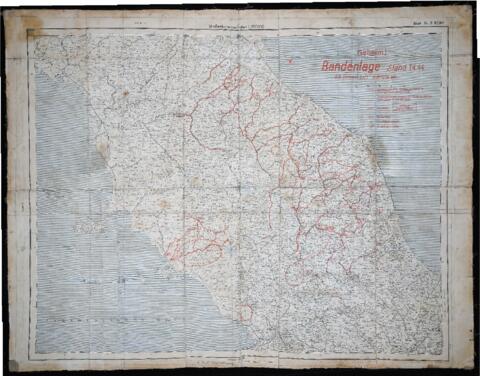
"Carta delle bande partigiane" - 1944
Date
- 1944 (Creazione)
Livello di descrizione
Unità documentaria
Consistenza e supporto
Carta geografica 70x100
Area del contesto
Nome del soggetto produttore
Istituto conservatore
Storia archivistica
Modalità di acquisizione
Area del contenuto e della struttura
Ambito e contenuto
Carta geografica dell'Italia centrale 1:500.000 trovata in tasca al capitano tedesco ucciso a Fermignano il 28 giu. 1944. La carta stampata dal Comando tedesco a partire dal 1 aprile 1944 riporta la posizione delle bande partigiane e le strade in cui le truppe tedesche potevano transitare scortate solo di giorno.